
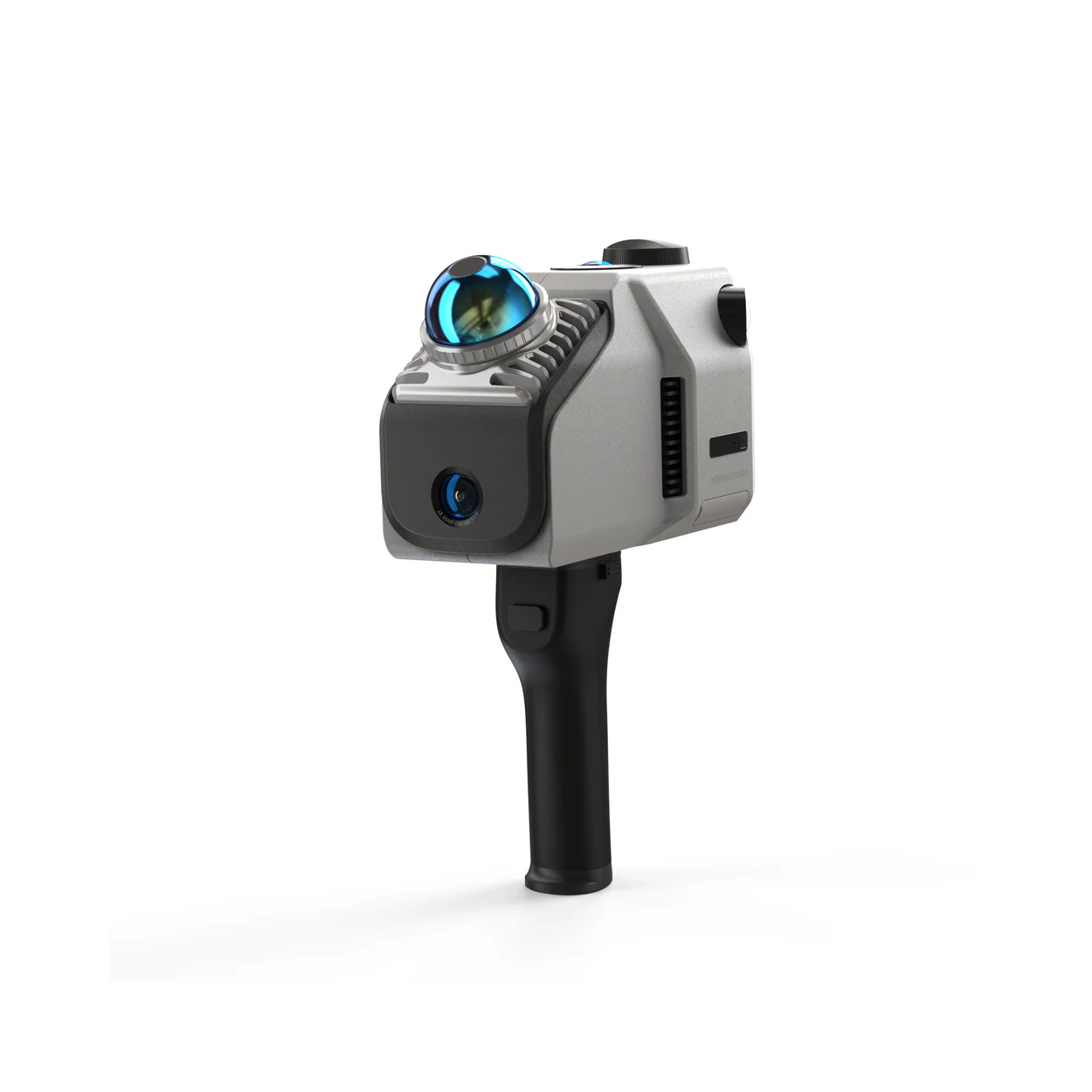
3DMakerpro Eagle LiDAR 3D Scanner
3DMakerpro Eagle LiDAR 3D Scanner
The 3DMakerpro Eagle is a handheld LiDAR 3D scanner designed for capturing buildings, rooms, outdoor environments and other large physical spaces. It combines long-range LiDAR measurement, SLAM positioning, high-resolution colour imaging and an integrated display to provide a complete mobile reality-capture workflow.
The Eagle Standard includes one 48MP fisheye camera and is suited to point-cloud capture, spatial measurement and general colour-mapping applications. The Eagle Max includes four 48MP fisheye cameras, providing more complete panoramic image coverage for 8K HDR textures, Gaussian Splatting, virtual tours and photorealistic digital environments.
Both Standard and Max editions are also supplied with an RTK module. The RTK-equipped configurations add positioning data to the captured scan, making them more suitable for surveying, construction documentation, site mapping and projects where models need to be aligned with real-world coordinates.
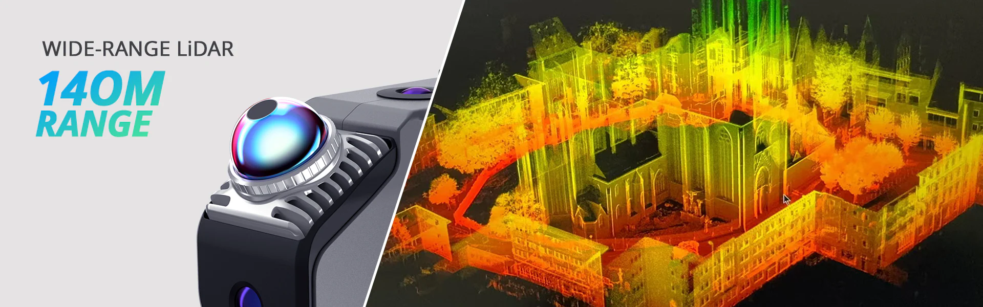
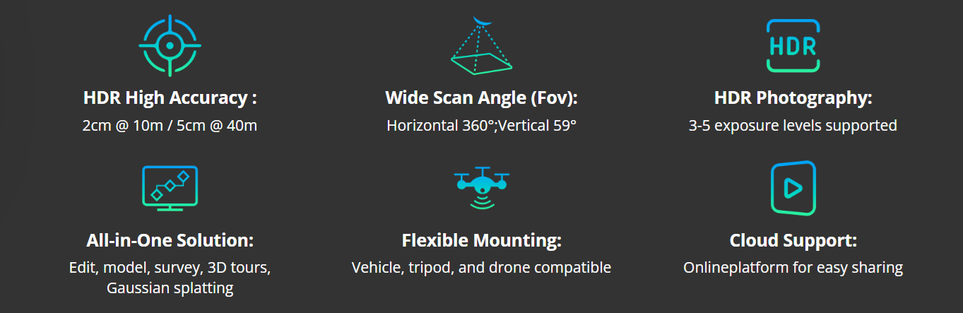
All Eagle editions use the same core LiDAR platform, including an 80–140m quoted scanning range, up to 200,000 captured points per second, 360° horizontal coverage and accuracy of up to 2cm at a distance of 10m.
Long-Range LiDAR Capture
Eagle is designed for recording large spaces that would be impractical to capture using a conventional short-range object scanner. Its LiDAR system provides a scanning radius of up to 70m on surfaces with suitable reflectivity and a total quoted scanning range of 80–140m.
The scanner records up to 200,000 points per second while the operator moves through the environment. This allows rooms, façades, roads, industrial sites and other large areas to be captured as continuous point-cloud projects rather than a series of separate stationary scans.
- 80–140m total quoted scanning range
- Up to 70m scanning radius
- Up to 200,000 points per second
- 2cm accuracy at a distance of 10m
Wide-Angle SLAM Scanning
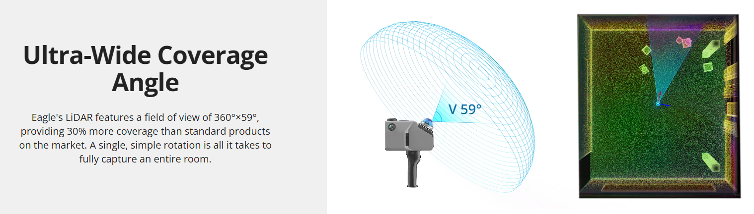
Eagle uses SLAM technology to estimate its position and align spatial data while it is moved through the scan area. This supports a more flexible mobile workflow, reducing the need to repeatedly position a tripod or manually align numerous individual scans.
A 360° horizontal and 59° vertical field of view captures a broad area around the operator. The wider vertical coverage is particularly useful when recording tall interiors, staircases, façades and environments containing structures above or below the scanner.
- 360° horizontal field of view
- 59° vertical field of view
- Real-time SLAM positioning
- Suitable for indoor and outdoor environments
48MP Colour Imaging and 8K HDR Output
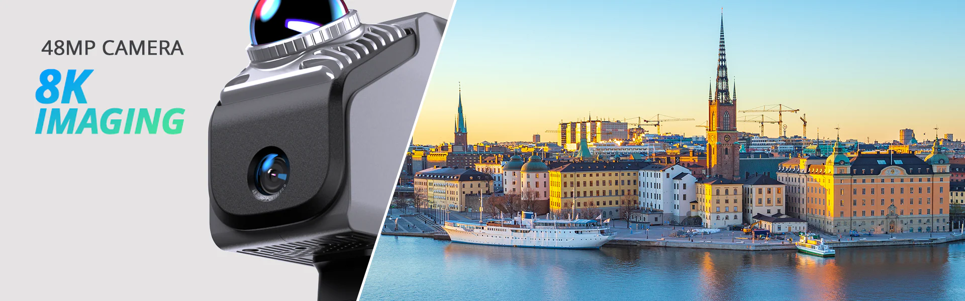
Eagle combines LiDAR geometry with high-resolution fisheye photography to produce colour point clouds, textured polygon models and panoramic visualisations. HDR capture supports between three and five exposure levels, helping preserve detail across environments containing both bright and shaded areas.
Eagle Standard uses one 48MP fisheye camera. Eagle Max uses four 48MP fisheye cameras positioned around the scanner, providing more complete panoramic coverage and reducing the number of visual gaps in captured colour data.
- One 48MP fisheye camera on Eagle Standard
- Four 48MP fisheye cameras on Eagle Max
- 8K panoramic colour output
- HDR capture with three to five exposure levels
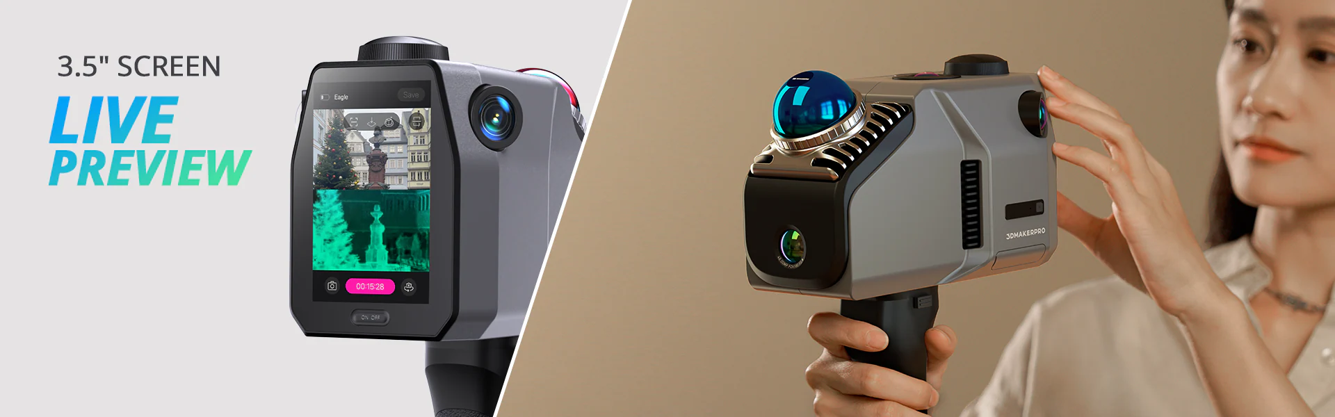
Live Preview and On-Site Review
An integrated 3.5-inch screen displays scan information while data is being collected. Operators can switch between point-cloud, photograph and split-screen display modes to monitor both geometric and visual coverage before completing the scan.
Completed projects can be reviewed directly on the scanner, including point clouds, photographs and GPS trajectories where positioning information is available. This helps operators identify missing areas while they are still on site rather than discovering gaps during post-processing.
- Integrated 3.5-inch screen
- Live point-cloud preview
- Photograph and split-screen display modes
- On-device review of completed projects
Flexible Mobile Mapping Platform
Eagle can be operated as a handheld scanner or attached to compatible tripods, bicycles, vehicles, backpacks and aerial platforms. The scanner can collect up to 200,000 points per second while moving at speeds of up to 20km/h, supporting faster capture of roads, streets and larger outdoor sites.
Optional mounting systems allow the same scanner to be adapted to different projects rather than requiring a separate capture device for each platform. This makes Eagle suitable for architectural documentation, construction monitoring, infrastructure mapping, film production and digital-twin creation.
- Handheld scanning operation
- Tripod, bicycle and vehicle mounting options
- Compatible with selected drone and backpack systems
- Dynamic data capture at speeds up to 20km/h
Point Clouds, Models and Eagle Configurations
Eagle supports multiple forms of spatial output, including colour point clouds, coloured polygon models, panoramic-tour data and Gaussian Splatting scenes. Captured data can therefore be used for both technical measurement and visual presentation.
The accompanying processing software includes point-cloud editing, AI-assisted denoising and data-optimisation tools. Projects can then be exported for use in platforms such as Revit, Blender and Unreal Engine, depending on the selected output and workflow.
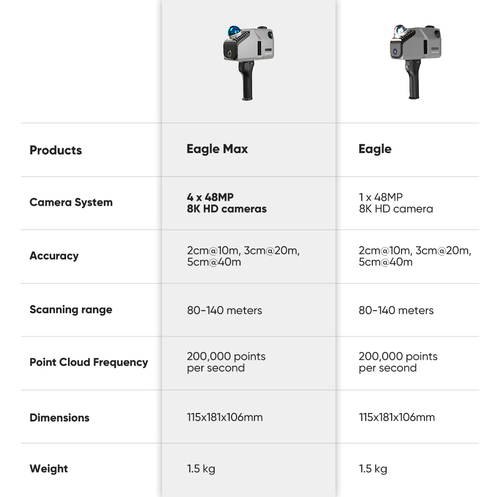
Eagle and Eagle Max share the same core LiDAR performance, including scanning accuracy, range and point-cloud frequency. The main difference is the colour-camera system: Eagle uses one 48MP camera, while Eagle Max uses four 48MP cameras for more complete panoramic image capture.
- Colour point-cloud export in PLY format
- Coloured polygon-model export in OBJ format
- Gaussian Splatting PLY output
- One 48MP camera on Eagle or four 48MP cameras on Eagle Max
Introducing the 3DMakerpro Eagle LiDAR Scanner
| Technical Specifications | Technical Specifications
Gaussian Splatting processing requires a compatible NVIDIA graphics card. |
||||||||||||||||||||||||||||||||||||||||||||||||||||||||||||||||||||||||||||
|---|---|---|---|---|---|---|---|---|---|---|---|---|---|---|---|---|---|---|---|---|---|---|---|---|---|---|---|---|---|---|---|---|---|---|---|---|---|---|---|---|---|---|---|---|---|---|---|---|---|---|---|---|---|---|---|---|---|---|---|---|---|---|---|---|---|---|---|---|---|---|---|---|---|---|---|---|---|
What’s in the Box?
| Included Item | Eagle Standard | Eagle Max | Eagle Standard RTK | Eagle Max RTK |
|---|---|---|---|---|
| Eagle Standard LiDAR Scanner | 1 | — | 1 | — |
| Eagle Max LiDAR Scanner | — | 1 | — | 1 |
| Handle | 1 | 1 | 1 | 1 |
| PD Power Adapter | 1 | 1 | 1 | 1 |
| 1.5m Dual-Ended USB Type-C Cable | 1 | 1 | 1 | 1 |
| 128GB TF Card | 1 | 1 | 1 | 1 |
| USB Type-C to USB Type-A Adaptor | 1 | 1 | 1 | 1 |
| RTK Module | — | — | 1 | 1 |
| RTK Positioning Accessory | — | — | 1 | 1 |
| Engineering Carrying Case | 1 | 1 | 1 | 1 |
The manufacturer’s written contents list confirms the scanner, handle, power adapter, USB Type-C cable, 128GB TF card and USB adaptor. RTK bundle contents are based on the manufacturer’s official package images. Package contents may be updated by 3DMakerpro.
