

3DMakerpro Raven LiDAR 3D Scanner-Max RTK (2 x Camera)
3DMakerpro Raven LiDAR 3D Scanner – Max RTK (2 x Camera)
The 3DMakerpro Raven Max RTK is a portable handheld LiDAR 3D scanner designed for large-area spatial capture, surveying, construction, BIM, GIS, digital twins and other professional applications where scan data needs to relate accurately to real-world coordinates. It combines Raven's long-range LiDAR and SLAM scanning system with dual 12MP colour cameras and integrated RTK positioning.
Unlike the standard Raven configurations, the Max RTK can receive RTK differential correction data through an NTRIP network or compatible local GNSS base station. With a suitable RTK correction source and clear satellite visibility, geographic positioning information can be incorporated directly into the captured point cloud, reducing the need for separate manual georeferencing and post-processing workflows.
The scanner retains Raven's handheld workflow, 360° × 40° field of view and capture rate of up to 150,000 points per second, allowing an operator to walk continuously through large indoor or outdoor environments while recording surrounding structures and topography.
RTK Positioning for Georeferenced 3D Scanning
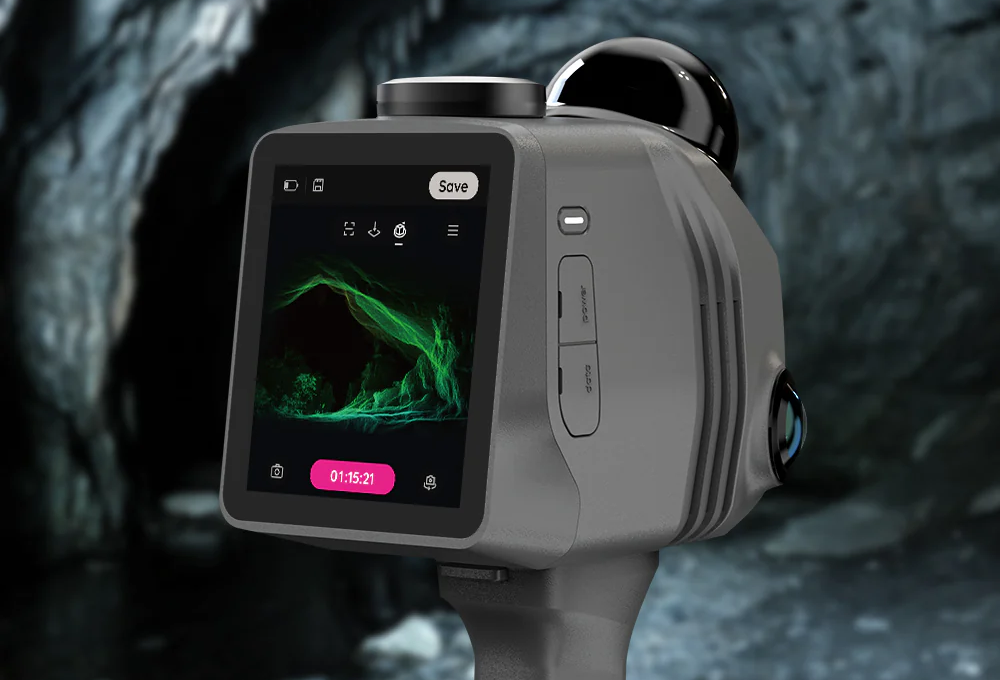
The Raven Max RTK adds real-time GNSS correction to the Raven scanning platform. For outdoor projects, the scanner can connect to an NTRIP correction service through an internet connection such as a smartphone hotspot or cellular field router. NTRIP server details, credentials and the required mountpoint are then entered through the RTK configuration interface.
Once a Fixed RTK solution has been established, positioning corrections can be applied while the LiDAR data is being recorded. With suitable RTK correction data and an unobstructed view of the sky, this workflow is designed to provide centimetre-level global positioning, allowing captured point clouds to be associated with real-world coordinates directly in the field.
Large-Area LiDAR Capture
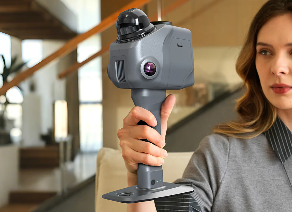
Raven Max RTK is designed for environments that would be inefficient to capture using a conventional short-range object scanner. Its LiDAR system can record up to 150,000 points per second while the operator moves through the survey area, with surrounding structures and terrain captured from distances of up to approximately 50–100 metres depending on the scanning conditions and target surfaces.
A 360° horizontal and 40° vertical field of view allows the scanner to capture a broad area around the operator while walking a planned scanning route. This makes the system suitable for buildings, construction sites, streets, outdoor infrastructure, caves, landscapes and other large physical environments.
Dual 12MP Cameras for Colour Capture
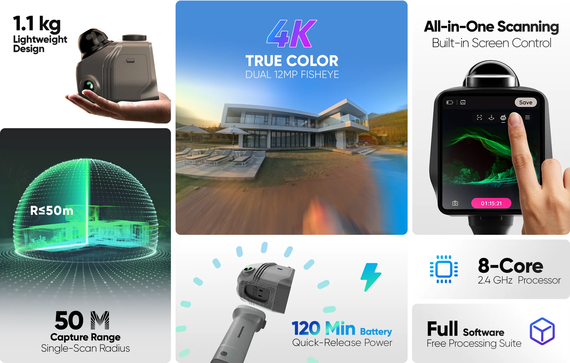
The Raven Max RTK uses two 12MP colour cameras alongside its LiDAR system. The dual-camera arrangement records additional visual information while scanning, providing broader colour coverage than the single-camera Raven configuration.
Colour data can be combined with the captured geometry for colourised point clouds, textured models and visual reconstruction workflows. This is particularly useful for digital twins, site documentation, visualisation and Gaussian Splatting projects where the appearance of the environment is important alongside its measured geometry.
SLAM Scanning Indoors and Without RTK
RTK positioning is not required for every Raven Max RTK scan. Inside buildings, underground or in other environments where GNSS satellite visibility is unavailable, Raven can continue capturing the environment using its internal SLAM positioning system.
SLAM combines captured spatial information and movement data to estimate the scanner's position as the operator moves through the environment. This allows dimensionally useful 3D models and point clouds to be produced without an active RTK connection, although these scans will not automatically carry the same absolute geographic positioning provided by an outdoor Fixed RTK workflow.
A Practical RTK Field Workflow
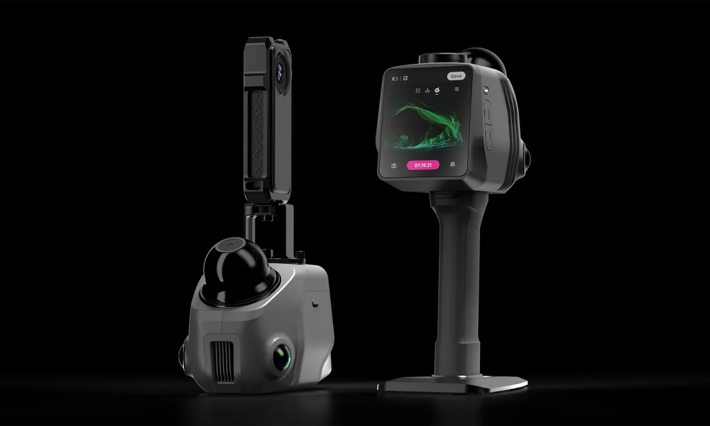
A typical Raven Max RTK field workflow begins by connecting the scanner to an internet-enabled network, such as a smartphone hotspot or dedicated 4G/5G field router. The operator then enters the credentials supplied by their chosen NTRIP correction provider and confirms that a Fixed RTK solution has been established before beginning the survey.
During capture, the operator walks a planned route through the target area while keeping the GNSS antenna exposed to the open sky wherever possible. LiDAR, positioning and image data are collected together, allowing geographic coordinates to be associated with the point cloud as the site is recorded.
From Field Capture to CAD and GIS
After scanning, Raven data can be transferred to a compatible workstation for processing and export. The system supports standard point-cloud formats including LAS, PLY and E57, allowing captured data to move into established CAD, GIS, BIM and point-cloud processing workflows.
For RTK-enabled outdoor projects, geographic positioning is incorporated during capture rather than relying entirely on manual alignment afterwards. This can simplify workflows where multiple scans, surveyed environments or other geographically referenced datasets need to be brought together in the same coordinate space.
Introducing the 3DMakerpro Raven
3DMakerpro Raven Max RTK FAQs
Does the Raven Max RTK require a separate physical base station?
No. The Raven Max RTK requires RTK differential correction data to achieve centimetre-level outdoor positioning, but this does not necessarily require your own physical base station. Its NTRIP workflow allows the scanner to receive corrections from a compatible public or commercial correction network over an internet connection. For remote locations without suitable network coverage, a compatible local GNSS base station can also be used.
Do I need a subscription to use RTK positioning?
It depends on the RTK correction service being used. Commercial NTRIP networks may charge a monthly or annual subscription, while some regions provide public or government-operated CORS correction networks that can be accessed without a commercial subscription. A suitable privately operated local base station can also provide correction data without relying on a subscription-based NTRIP service.
Can I use the Raven Max RTK indoors or without an active RTK connection?
Yes. When satellite positioning is unavailable, such as inside buildings or underground, Raven can use its internal SLAM system to track movement and construct the surrounding environment. The resulting scan can still provide a dimensionally useful 3D representation, but it will not automatically be tied to absolute real-world geographic coordinates in the same way as a Fixed RTK outdoor scan.
What positioning accuracy can the Raven Max RTK achieve?
With suitable RTK correction data, a Fixed RTK solution and a clear view of the sky, the supplied Raven RTK documentation specifies centimetre-level global positioning. Actual results will depend on factors including satellite visibility, correction quality, the surrounding environment and field conditions.
Is Raven Max RTK data compatible with CAD and GIS software?
Yes. Raven can export standard point-cloud formats including LAS, PLY and E57 for use in compatible CAD, GIS, BIM and point-cloud processing software. With an RTK-enabled outdoor workflow, geographic positioning can be incorporated into the captured data, reducing the need to manually georeference the point cloud before using it alongside other spatial datasets.
| Technical Specifications | Technical Specifications
Gaussian Splatting processing requires a compatible NVIDIA graphics card. |
||||||||||||||||||||||||||||||||||||||||||||||||||||||||||||||||
|---|---|---|---|---|---|---|---|---|---|---|---|---|---|---|---|---|---|---|---|---|---|---|---|---|---|---|---|---|---|---|---|---|---|---|---|---|---|---|---|---|---|---|---|---|---|---|---|---|---|---|---|---|---|---|---|---|---|---|---|---|---|---|---|---|---|
What's in the Box?
| Included Item | Quantity |
|---|---|
| Raven Max LiDAR scanner | 1 |
| RTK kit | 1 |
| Battery grip | 1 |
| Holder base | 1 |
| Protective case | 1 |
| 128GB TF card | 1 |
| TF card reader | 1 |
| Carrying case | 1 |
Box contents may be updated by the manufacturer. Please check the selected edition before ordering.
